Situated next to the George Communication tower

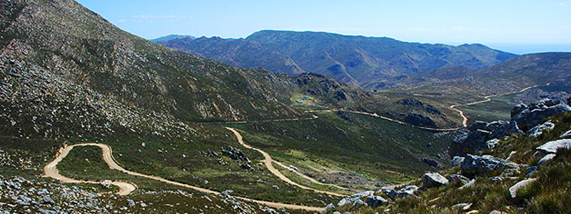
George Peak paragliding site is situated a next to the George Communication tower above the town of George in the Garden Route. The site was discovered and test flown by Johnnie and Deon Borrett who got the initial agreements in place that was ratified by the Skywings Club and the relevant landowners. The site is about 70-80m above the landing zone which forms a ledge, but the site sits about 300m from the valley below. The problem at the moment is that the plantation forest growth has put landing zone in rotor and shadow and makes for tricky landings. The site has delivered some nice flights and has immense XC potential. Access is thorugh the gate and permission must be arranged with Cape Nature. At present the site is not really used in favour of Tolberg. Skywings used to have an annual hike and fly off George Peak launching just below the peak. This has now stopped due to the path becoming overgrown and conservation has moved the path to a much longer route.
Skywings Club Site
- Height: 70m 360 ASL
- Wind direction and speed: 10-25 km SE S SW
Contact :Deon Borrett 072 1990622
GPS coordinates: 33°54'25.25"S 22°27'36.24"E
Records: No official records yet, but flights of 20-30km have been done by club members, so come and make your mark and fly some distance.
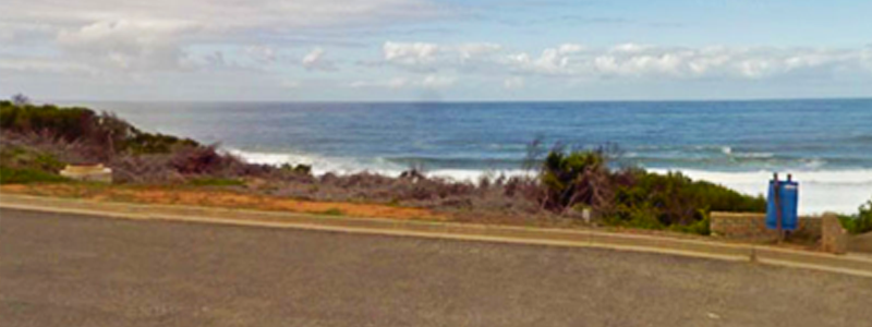
Hartenbos Bayview Take-Off 1-2 Nooitgedacht Avenue (Skywings)

Skywings Club Site
- Wind : E : 26 - 28 Km / h
- ASL and above ground height : < 300 m
Rules & Regs :
- Land away from and respect people on beach
- Dangers : strong wind site - only intermediate to advance pilot.
Contact details : Frikkie Gouws - 072 237 4054
Observer for area details : Frikkie Gouws - 072 237 4054
GPS co-ordinates : -34.132992, 22.114792
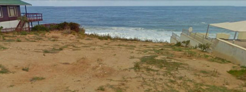
Hartenbos Bayview Take-Off 1-1 Hannes Pienaar Street (Skywings)

Skywings Club Site
- Wind : E : 26 - 28 Km / h
- ASL and above ground height : < 300 m
- GPS co-ordinates : -34.138809, 22.112346
Rules and Regs :
- Land away from and respect people on beach
- Dangers : strong wind site - only intermediate to advance pilots
Contact details : Frikkie Gouws - 072 237 4054>
Observer for area details : Frikkie Gouws - 072 237 4054
Friemersheim Best for experienced pilots

Not an easy site to find and it's best to ask the local Mossel Bay Skywings pilots to go with. It's a tricky site and the landing area is not ideal. Best for experienced pilots. Works in any Southerly wind.
Dana Bay Take-Off 2-1 Nutans Street

Skywings Club Site
- Wind: SSE to SSW: 24 - 28Km/h (if wind is to strong for 1st Beach launch)
- ASL and above ground height: < 300m
Rules and Regs:
- Very sensitive residents - Treat with respect - Don't fly over houses
- Dangers: Only fly off towards right hand side untill enough height obtained
Contact details: Frikkie Gouws - 072 237 4054
Observer for area details: Frikkie Gouws - 072 237 4054
GPS co-ordinates: -34.205831, 22.038462
Records if any (mainly lekker flights distance or flying to a point and back): Fly to St Blaize and top land on meshy sports field
Any special arrangements: Note position of Stairs to walk back up
Dana Bay Take-Off 1-2 Cynaroides Street Car Park
Skywings
- Wind: SSE to SSW: 20-26Km/h
- ASL and above ground height: < 300 m
Rules and Regs:
- Very sensitive residents - Treat with respect - Don't fly over houses
- Dangers: First fly into stronger wind component before going on on XC trips
Contact details: Frikkie Gouws - 072 237 4054
Observer for area details: Frikkie Gouws - 072 237 4054
GPS co-ordinates: -34.204285,22.050805
Records if any: Fly to St Blaize and top land on meshy sports field (or return)
Any special arrangements: Note position of Stairs to walk back up
Dana Bay Take-Off 1-1 Malva Road
Skywings Club Site
- Wind: SSE to SSW: 20-26Km/h
- ASL and above ground height: < 300 m
Rules and Regs:
- Very sensitive residents - Treat with respect - Don't fly over houses
- Dangers: First fly into stronger wind component before going on on XC trips
Contact details: Frikkie Gouws - 072 237 4054
Observer for area details: Frikkie Gouws - 072 237 4054
GPS co-ordinates: -34.204442,22.053836
Records if any: Fly to St Blaize and top land on meshy sports field
Any special arrangements: Note position of Stairs to walk back up